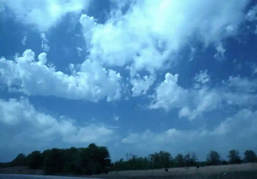
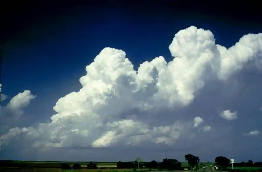
Clouds are visible indications of atmospheric processes which provide clues on frontal activity and general weather patterns
While there is no requirement for a pilot to be able to identify every cloud type by name and classification, basic knowledge can mean the difference between a comfortable flight, and a dangerous one
Much like a river, as you approach, you can get a feel for currents and stability by how it looks - Clouds are no different
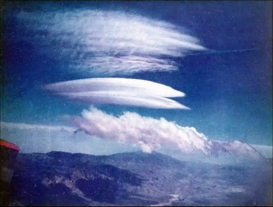
Lenticular clouds form on the leeward side of mountains [Figure 6]
Cap Clouds:
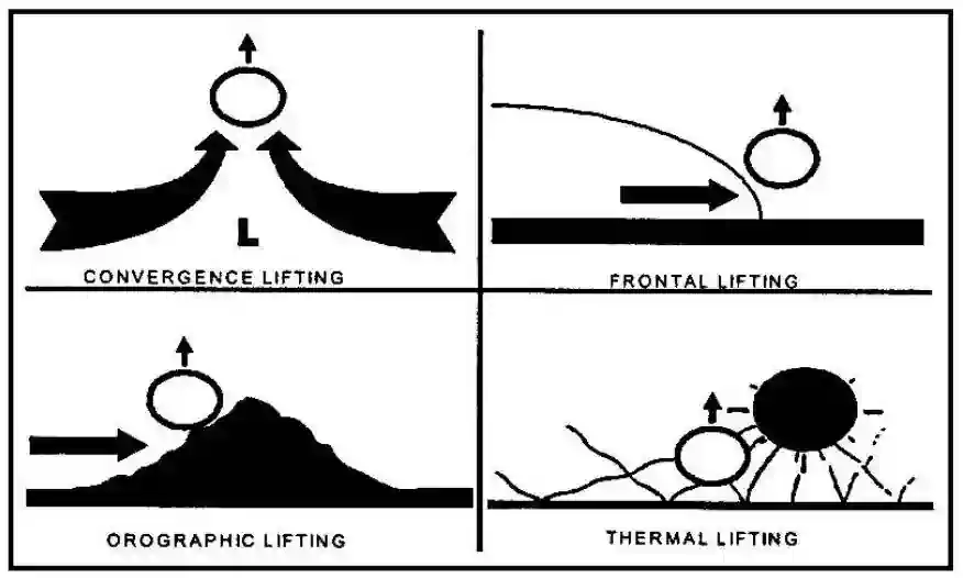
Form during rising air
Rotor Clouds:
Rotor clouds are typically associated with turbulence [Figure 6]
They are indicitive of a local rolling wind phenomenon
Just as important, however, is their presence alerts pilots to the possibility of extreme updrafts followed by extreme downdrafts, in rapid succession
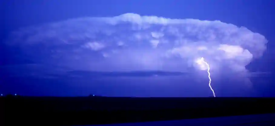
Roll and Wall Clouds:
Occur in severe and fast-moving thunderstorms
Advisory Circular (00-45) Aviation Weather Services, Lenticular and Rotor Clouds
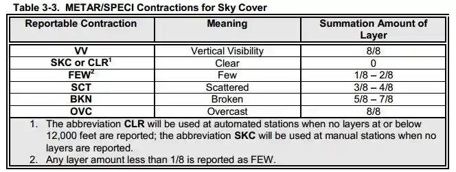
Reporting Prevailing Visibility:
Aviation Routine Weather Reports (METARs) declare surface (horizontal) visibility in terms of statute miles and increments thereof; e.g., 1/16, 1/8, 16, 1/4, 16, 8, 2, 5/8, 3/4, 7/8, 1, 1 1/8, etc. (Visibility reported by an unaugmented automated site is reported differently than in a manual report, i.e., Automated Surface Observation System/Automated Weather Observation System) (ASOS/AWOS): 0, 1/16, 1/8, 1/4, 1 1/2, 1 3/4, 2, 1 3/4, 1, 1 1/4, 1 1/4, 2, 2 1/2, 3, 4, 5, etc., AWOS: M1/4, 1/4, 1/2, 3/4, 1, 1 1/4, 1 1/2, 1 3/4, 2, 2 1/2, 3, 4, 5, etc.) The ability to see and identify preselected and prominent objects at a known distance from the usual point of observation determines visibility. Visibilities that are determined to be less than 7 miles identify the obscuring atmospheric condition; e.g., fog, haze, smoke, etc., or combinations thereof
Prevailing visibility is the greatest visibility equaled or exceeded throughout at least one-half of the horizon circle, not necessarily contiguous. Segments of the horizon circle which may have significantly different visibility are reported in the remarks section of the weather report; i.e., "the southeastern quadrant of the horizon circle may be determined to be 2 miles in mist while the remaining quadrants are determined to be 3 miles in mist"
When the prevailing visibility at the usual point of observation, or the tower level, is less than 4 miles, certificated tower personnel will take visibility observations in addition to those taken at the usual point of observation. The lower of these two values becomes the prevailing visibility for aircraft operations
Ceiling, by definition in the Code of Federal Regulations and as used in aviation weather reports and forecasts, is the height above ground (or water) level of the lowest layer of clouds or obscuring phenomenon that is reported as "broken," "overcast," or "obscuration" [Figure 7]
Example: a Terminal Aerodrome Forecast (TAF), which reads "BKN030" refers to the height above ground level indicates that the height is above mean sea level
The Aeronautical Information Manual defines "broken," "overcast," and "obscuration"
Pilots usually report height values above Mean Sea Level (MSL) since they determine heights by the altimeter
This is taken into account when disseminating and otherwise applying information received from pilots
"Ceiling" heights are always Above Ground Level (AGL)
In reports disseminated as Pilot Reports (PIREPs), height references are given the same as received from pilots, that is, above MSL
In area forecasts or inflight advisories, ceilings are denoted by the contraction "CIG" when used with sky cover symbols as in "LWRG TO CIG OVC005," or the contraction "AGL" after the forecast cloud height value
When the cloud base is given in height above MSL, it is indicated by the contraction "MSL" or "ASL" following the height value
The heights of clouds tops, freezing level, icing, and turbulence are always given in heights above ASL or MSL
Improve your weather skills with FAA provided (and WINGS credited) resources by going to https://www.faasafety.gov/ and type "weather" into the search bar